Photo: Photo: Fulshang, CC BY-SA 4.0, via Wikimedia Commons
Planning, land & policy
Dholera Map Explained: SIR Boundaries and TP Schemes
Verified FreshUpdated 13 Sept 2026· 1 min read
Quick answer
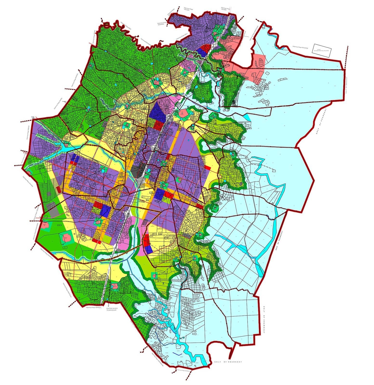
The Dholera map has three layers that are easy to confuse.
The Dholera map has three layers that are easy to confuse. The outer boundary is the Dholera Special Investment Region, a planned area of about 920 sq km in Ahmedabad district near the Gulf of Khambhat, roughly 100 km south-west of Ahmedabad city. Inside it, the land is divided into six Town Planning schemes, TP1 to TP6, each a defined block of the region.
The most developed layer is the Activation Area, about 22.5 sq km within TP2, where trunk roads, utilities and the command centre already exist. Most of the wider 920 sq km is still farmland and future phases planned toward 2040, so a plot being on the Dholera map is not the same as it being on built infrastructure.