Dholera Activation Area Explained (2026): What's Actually Built
Verified StaleUpdated 1 Aug 2026· 3 min read
Quick answer
The Activation Area is Dholera's built demonstration zone — about 22.5 sq km within Town Planning Scheme 2, roughly 2.4% of the notified region. This is where the trunk roads, underground utilities, drainage, water supply and the ABCD command-and-control building actually exist. Official accounts describe its trunk infrastructure as substantially complete. It is the single strongest signal of real progress — and the clearest corrective to the 920-sq-km headline.
If Dholera has a beating heart in 2026, it is the Activation Area. Everything that lets the project claim it is real rather than notional is concentrated in this one zone of about 22.5 sq km. Understanding it — what it is, what is built, and what it is not — is the single most important corrective to the hype.
Area
About 22.5 km²
Location
Within Town Planning Scheme 2 (TP2)
Share of region
About 2.4% of the ~920 km² notified area
Purpose
Demonstration zone, built first to prove the city can be delivered
The Activation Area was conceived as a demonstration — a first phase built to show the master plan could be translated into functioning infrastructure. On the regional map it is a small rectangle inside a very large region, and that ratio, about 2.4 per cent, is the single most important thing to remember. Being inside the 920-sq-km boundary says nothing about whether roads, power or water reach a parcel; proximity to the Activation Area and its delivered infrastructure is the far stronger signal.
What is actually built
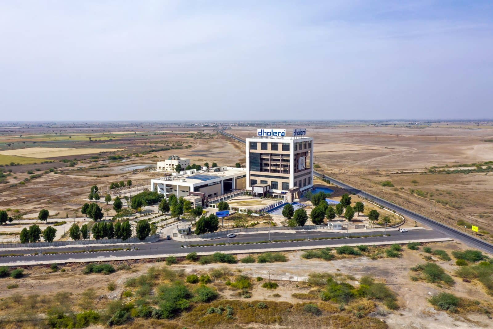
Within the Activation Area, the elements that distinguish a planned smart city from organic sprawl have genuinely been installed: motorable spine roads on the planned grid; underground utilities carrying power, water, drainage and communications in service ducts rather than overhead lines; a water supply and drainage system; and the ABCD building — the Administrative and Business Centre — which houses the command-and-control centre. By official accounts the trunk infrastructure is substantially complete, and the national corridor corporation describes it as nearly complete.
Built element
What it is
Spine roads
Motorable trunk roads on the planned grid
Underground utilities
Power, water, drainage and communications in service ducts
Water and drainage
Water supply and drainage system
ABCD building
Administrative and Business Centre with the command-and-control centre
What "smart" actually means here
"Smart" is the most abused word in the Dholera vocabulary. Grounded in the plan, it refers to concrete engineering: a central utilities-and-technology backbone, with power, water, sewerage, drainage, gas and communications laid in underground ducts along the roads, so a new plot can be connected to every service without tearing up a road. Layered on that is an intelligent-infrastructure layer, monitored from the command centre.
The honest caveat is that this layer becomes meaningful only once there is a populated city to manage.
The genuine achievement, and the genuine limit
The genuine achievement is that the backbone exists: a visitor sees built roads, service infrastructure and the command building on land that was farmland a decade ago. The equally genuine limit is that a serviced backbone is not a city. The Activation Area today is closer to an exceptionally well-prepared platform than to a populated place — an impressive, largely unused capability waiting for the demand that would make it matter.
That distance, measured in demand, jobs and years rather than in cement, is the distance Dholera still has to travel.
Frequently asked questions
What is the Dholera Activation Area?
It is Dholera's built demonstration zone — about 22.5 sq km within Town Planning Scheme 2 — where the roads, underground utilities, drainage, water supply and the ABCD command building actually exist. It is roughly 2.4% of the notified region.
Is the Activation Area finished?
Its trunk infrastructure is reported substantially complete by official accounts. But a serviced backbone is not a populated city; the resident economy is still largely ahead.
What is the ABCD building?
The Administrative and Business Centre, which houses the command-and-control centre for the Activation Area's intelligent-infrastructure layer.
Why does the Activation Area matter for buyers?
Because delivered infrastructure, not the outer boundary, is the real signal. Proximity to the Activation Area indicates where roads, power and water actually reach.
How much of Dholera is the Activation Area?
About 22.5 sq km, or roughly 2.4% of the ~920-sq-km notified region — a small built core inside a very large planned area.
4.Sarkhedi, B. (2026) Dholera SIR: A Comprehensive Review, 2006 to 2026 (working paper)
Figures are dated and attributed; targets are distinguished from delivered facts. Verify time-sensitive figures against current official sources before relying on them.